Sigiriya
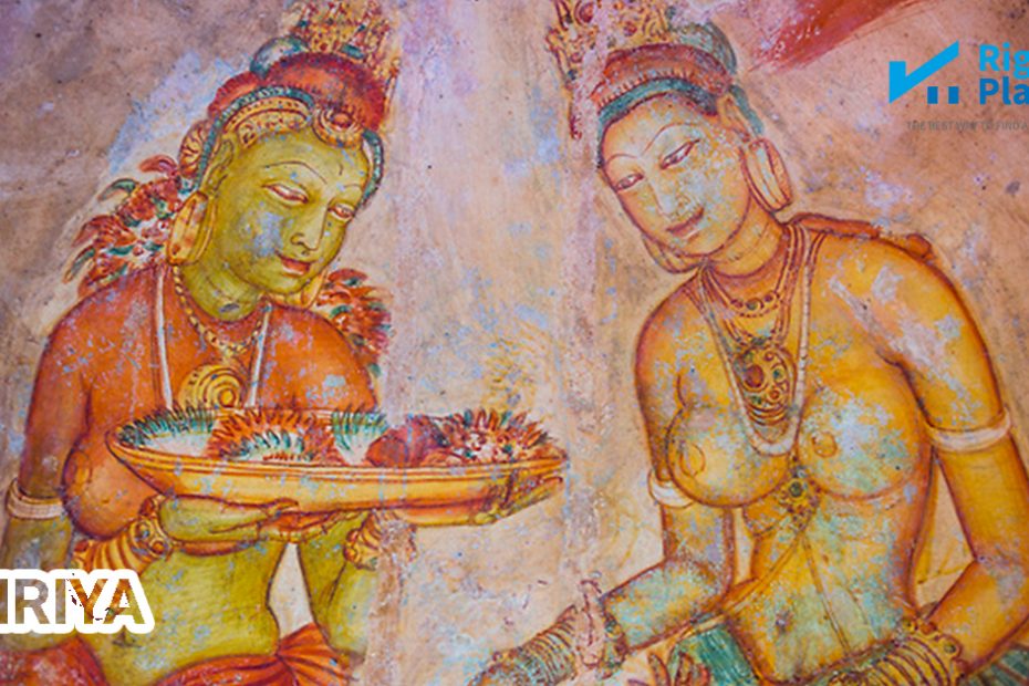
 Sigiriya literally means ‘Lion Rock’ after the shape of entrance to the rock fortress which was in the form of a recumbent lion whose remnants could still be seen in the gigantic paws at the entrance to the palace. A palace indeed, for it served for a short period of about a decade and a half as the political hub of Sri Lanka. Sigiriya is probably the best preserved and glorious of the surviving, planned cities of South and Southeast Asia of the first millennium of the Christian era. For a number of reasons including its fascinating surroundings, its plan and conception and its degree of preservation, Sigiriya occupies a foremost position in the history of urbanism in Asia. Sigiriya’s urban form consists of a series of central environs, the outer moat of which not yet completely explored – seems to form a correctly geometrical rectangle. These successive environs are centered on the grand Sigiriya rock. The city plan has been identified as a rectangular form almost 3km from east to west and 1km from north to south.
Many who visit Sigiriya believe that this urban centre reveals only Kashyapan period (C.5th century AD) architectural characteristics, but the archaeological evidence prove that Sigiriya has pre-and post- Kashyapan phases. Indeed it has as many as ten phases.